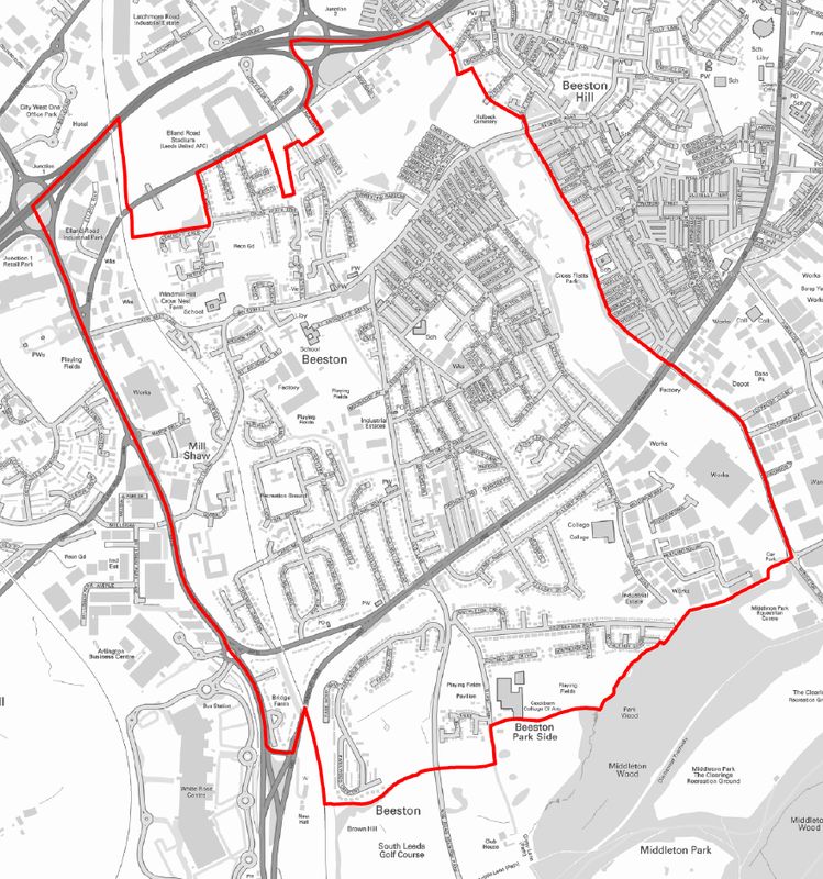
Plan AreaThe Beeston designated area was approved by Leeds City Council on 24th February, 2014.
The designated area includes the area bounded by the northern edge of Cross Flatts Park, the M621, the Leeds Outer Ring Road and the western edge of Middleton Woods. The land around Elland Road associated with Leeds Utd football club is within the scope of Leeds City Council development plans and is not included. In 2017 the area around Stanks Barn was added and we await a revised map to illustrate this. The boundary of the Beeston Neighbourhood plan area is illustrated on the map below.Additionally, you can download a copy in pdf format by clicking the link below
|

| ||
Beeston Plan area
